We are sitting in the Ceilidh Place in Ullapool, sipping excellent flat whites while attractive waiting staff dressed in black dart between the tables, which are busy with the Sunday brunch crowd. While I’m feeling gratified – Ullapool marks the CWT’s unofficial halfway point – I also feel mightily self-conscious, having not washed for four days and having walked in the same clothes for so long that I wouldn’t be surprised if they could stand up on their own. Feral Sam doesn’t quite fit in here, among the glossy-haired people in chunky jumpers and jeans. Still, we enjoy the vibe, the warmth and the sweetcorn fritters while we can, and soon we’re back in our damp-and-dirty comfort zone, surveying the local campsite for a suitable spot to pitch the trusty tent.
Today’s walk has been a real quad trasher; we’ve descended 400m twice – and in between, we regained every metre of the height we’d lost with a steep hack up to a flat expanse of moor. Luckily, the views over Loch Broom and the mountains to the north compensated for my knees being on fire.
After setting up camp on the shores of Loch Broom, we had an exciting excursion to make: the local Tesco superstore! Our supplies of instant porridge, powdered milk, hot chocolate and on-the-road snacks lasted just about long enough to get us here but now, we’re out of almost everything. Food shopping has rarely been performed with such joy…
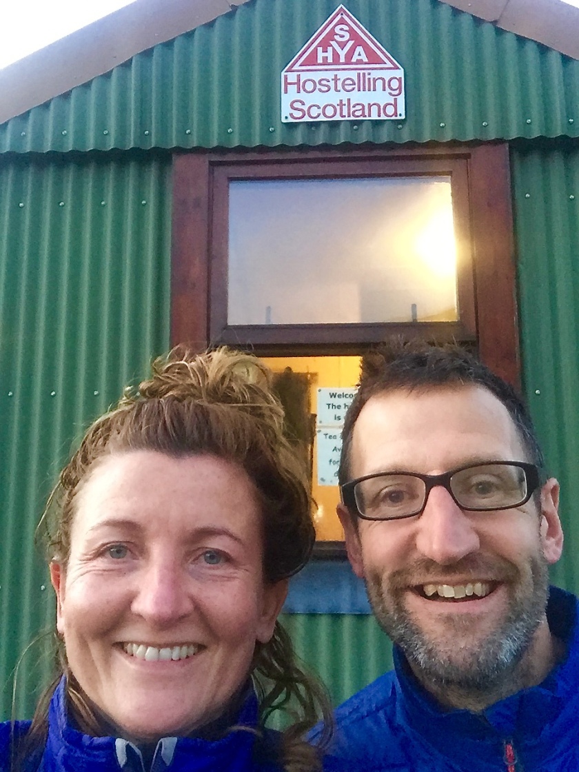
Reaching Ullapool does feel like a cause for celebration – it seemed such a distant place when we set out from Fort William, and it gives us confidence that one day soon we’ll be walking up to that lighthouse at Cape Wrath.
The next day, however, when we repack our rucksacks ready to hit the road again, it’s sobering to realise just how light we’ve been travelling recently. I’d assumed I was getting fitter and stronger, but now I wonder if it’s simply that my bag was getting emptier. With the Tesco bounty, plus a new batch of dehydrated meals and dog food (which we’d sent to ourselves to collect at Ullapool post office), we are fully loaded. And we have a 20-mile day to kick off the second half of our journey…
Back home in East Sussex, I’m occasionally kept awake by a vixen screaming – or woken early by pigeons cooing sweet nothings at each other on the windowsill – but I’ve never had my sleep interrupted by a beast as large as this one.
It’s a red deer, and, it being rutting season, he’s strutting his stuff along the high cliffs of the glen in which we’ve pitched our tent, his primal roar issuing forth at regular intervals. If you haven’t heard a stag roar, imagine a yawn combined with a deep bellow and you’ll be somewhat in the picture. I lie in the darkness and listen, enthralled by this living, breathing force of nature.
It’s a reminder that we’re back in the wild after the big city lights of Kinlochewe (population: 60). Our next brush with civilisation will be Ullapool, where our restock package – plus an outdoors shop and a supermarket – awaits.
We left Kinlochewe on easy, well-made tracks – but we knew from the guidebook that it wouldn’t be all be plain sailing. ‘Enjoy the steady going while it lasts,’ it advised. ‘It gets tougher from here.’ And it does.
We climb a hillside that rises to a plateau surrounded by peaks from which, in the distance, we can see Loch an Nid, which we need to walk the length of. Despite our relentless forward progress, the loch never seems to get any nearer. We’ve been on the move for eight hours by the time we reach its far end and by then the wind is blowing hard, ripping tears from my eyes.
We pitch the tent below the loch, where it drops down to a river, hoping for some shelter – but we still need to use every guy rope, and weigh the pegs down with rocks. And it takes ages to get the hot water to boil for dinner…
I wake early the next day and get up, hoping to catch a glimpse of the stag, whose roar is once again echoing around the glen. We’re not in any great hurry as we plan to spend the next night at the bothy at Shenavall, which is only six miles away. We’ve not managed a bothy stay yet, and this one is meant to be splendidly situated, beside a waterfall.
It’s a promising start as we make our way along the river, where an abundance of trees makes me realise that there’s been a distinct lack of them over the last few days – I’ve missed them.
But we can’t help also noticing an abundance of bright dots of colour on the path ahead and on converging tracks; the oranges and reds of waterproof jackets and rucksacks of other hikers. It’s Saturday, we realise – and Scotland has come out for a walk in the hills.
When we reach Shenavall, the bothy is already crowded and messy – people’s gear strewn around and food lying on the counter, just under the sign saying ‘Don’t leave food out, it attracts mice.’ Both the sleeping areas already have mats and sleeping bags in them. This isn’t the mountain bothy idyll we had in mind at all. We brew some tea outside in the sun and make the decision to carry on. Shortly after, we pass a contingent of young lads heading that way with a cargo of vodka, coke and bags of logs.
We make good progress on the trail before finding a particularly lovely riverbank on which to pitch the tent. The party at the bothy is probably only just getting started by the time we’ve eaten dinner beside our (very first) campfire and are thinking about going to bed to listen to our very own stag night.
I’m bundled up in my sleeping bag, listening to the river tumbling along its rocky bed. The sound of running water has become my nightly lullaby on this trip – it shushes, tinkles, burbles and roars. Beneath its music, I occasionally catch another sound so like the faint murmur of voices that it makes me understand why brooks are said to babble.
It’s been a long day – eleven hours of walking – and, despite wall-to-wall sunshine, the hardest yet. We’ve toiled across miles of pathless territory, first traversing the slopes of lofty Beinn Dronaig and later, (after some respite along a clear, if soulless, forestry track) picking our way through disorientating boulder fields. Lucky I married a former British Orienteering champion who, with map and compass in hand, took it all in his stride.
We stopped to cook dinner in a sheltered spot among the boulders while the last of the sun lingered, realising that by the time we made our descent to the river where we planned to camp it would be getting dark. We were starving, as usual, so Brownie points to me for not throwing a huge tantrum when Jeff KNOCKED THE PAN OFF THE STOVE, and our Mexican chilli ended up on the ground (Morris quickly moving in to hoover up).
You’d have done the same…
We salvaged what we could, and after we’d negotiated the horrible stony descent and pitched the tent in fading light, compensated for the calorie deficit with huge mugs of hot chocolate.
As I lie on my now-mended sleeping mat, enjoying the feeling of being horizontal – and straining my ears to make out those watery voices – I reflect on how stripped back and simple (simple, not easy) life is on the trail. Our entire focus each day is to get from A to B successfully, to be fed and watered and to get shelter and rest. We have no connection – virtual or actual – with the outside world and therefore no distraction. It’s remarkably liberating – and, I reckon, good for your mental health; like having a holiday from your usual self. The craving for news, the fomo, that habitual drive to share everything on social media – it all fades into the background when the big issues of the day concern dry socks, hot drinks and whether you’ve got any Pepperami left. Luckily for Jeff, I have…
Ever since I first read about The Falls of Glomach in the Cape Wrath Trail guide, I’ve been worrying about this day. It’s one of the highest waterfalls in Britain, with a ‘single leap’ drop of 113m – and we need make our way from the top to the bottom. I’m not great with heights – or descents – and the guide says: ‘the path can be quite tricky as it hangs onto the west side of the gorge and goes over several awkward rock steps.’ Then: ‘the path takes you down the ravine, precariously over several narrow and rocky sections – take great care, a slip could be dangerous.’ These words have haunted me (I’d somehow even switched the word ‘dangerous’ to ‘fatal’ in my mind) so I’m feeling anxious and yet also relieved the waiting is over as we hike out of Morvich on another beautiful morning. It’s an easy start along a river path before we start to climb up through forest that opens out onto open moorland.
We hear the thundering water of the Falls long before we see them, and stop for a rest and a snack before beginning the descent. It might only be cheese and salami, but it feels like The Last Supper.
The path starts off only mildly alarming – and strangely, heads slightly upwards rather than down as it traverses the side of the ravine. Then we start to descend steeply, with big drops to our right that I dare not look at. The rock steps are the worst bits: here, the narrow path gives way to a series of slick, slippery sheets of rock that we have to clamber over. I can’t imagine ever finding it easy but doing it with my rucksack on is simply terrifying. Once Jeff realises the extent of my fear he is heroic in helping me down, instructing me exactly where to put my feet and relieving me of the walking poles, which are helpful on the path but a hindrance over the rock steps.
Then all of a sudden, we’re on flat ground, beside a river. I insist we celebrate with a brew and we sit in a lovely sunny spot while I congratulate myself on surviving the descent and declare it wasn’t that bad after all.
But oh, what a mistake I’ve made… Within minutes of setting off from the nice, flat riverside, we find ourselves back at the edge of the ravine on a path that teeters on the edge of the long, steep drop. When we hit the first of a new set of rock steps, I start crying at the injustice of it all and with all my adrenaline spent, progress into a full-scale panic attack. My fear turns me so far away from the edge that I’m actually facing inwards on the path, making futile grabs at clumps of moss and blades of grass growing on the rock for support, which come away in my hand and make me cry harder.
It’s a long and hard ordeal (for both of us!) but finally the path bottoms out at the foot of the gorge and we slog through deep mud alongside the Elchaig river before picking up a wide, easy track.
I’m quiet as we walk along, turning the experience over in my head. I’m disappointed in myself for losing control – and for being ‘tricked’ that we’d made it when we barely halfway – but on the other hand, it was as bad as I’d ever imagined it and I did at least make it down alive – carrying my own rucksack the whole way. I allow myself a small pat on the back.
A couple of miles along the track, we find ourselves in such an idyllic setting (near Carnach, east of Loch na Leitreach for any potential CWTers) that we decide to pitch up for the night. We’ve just put our gear down when Morris detects movement in the long grass and pounces, emerging with a shrew in his mouth that he proceeds to devour in about four mouthfuls. So much for idylls.
When we told friends, family and colleagues we were doing a long-distance walk, some asked questions about the logistics of life on the trail. How would we charge our phones? How would we wash? Wouldn’t we be freezing in a tent? Where would we get water? What about going to the toilet?
As far as this last question is concerned, we’ve brought a genteelly named ‘cat shovel’ with us, which we stow along with a ziplock bag containing loo roll and hand sanitiser.
Usage recommendations are printed on it: Ensure you are 70 paces from any trail, habitation or water source. Dig a hole 6-8 inches deep. Leave no trace.
I was beginning to wonder if I’d ever need to use it: my bowels seemingly having decided to shut up shop rather than be subjected to digging holes like a cat. But day four dawns with that cannot-be-ignored urgency and I make a beeline to the nearby marshy hillocks, casting nervous glances and clutching the shovel and bag, to perform my debut. Digging the hole in peaty soil proves to be quite a physical task but, job done (if you’ll excuse the pun), it’s quite satisfying to bury the evidence.
As to those other questions: We have a clever LED lantern, which also serves as a charger, providing 3-4 phone charges as well as lighting up our evenings in the tent. (Not that we’ve needed our phones for anything other than taking photos, mind you – we said goodbye to both wifi and mobile reception when we walked out of Fort William.)
We get water from flowing streams, springs and waterfalls along the way. It’s coming off the mountains, so it’s very unlikely to be contaminated by humans or livestock. If we’re at all dubious, we walk on – and if we’ve no choice, we put it water-purifying tablets.
As far as washing ourselves goes, we have a pack of giant wet wipes. My hair goes under a hat. We aren’t carrying washing gear or towels – they’re too heavy. We quite possibly stink, but we can always blame it on Morris.
Keeping warm in the tent? We go to bed wearing hats, socks and numerous layers – and Morris kindly divides his time evenly between our two sleeping bags, acting as a furry, occasionally growl-emitting hot-water bottle.
I’m feeling unusually cold and stiff on this particular morning, having woken up in the night to find that my self-inflating sleeping mat had punctured and I was, in effect, lying on the floor. It’s remarkable how much insulation you get from a thin pocket of air. I try not to think about the many nights ahead before we reach Ullapool, our first town and re-stocking point.
On the plus side, the day is unfolding unseasonably warm and sunny. After breakfast (and OK, I admit, coffee at the Cluanie Inn) we set off along the blissfully easy tarmac road for a mile or so before picking up a track that climbs north, gradually levelling out and becoming rougher and wetter until it’s half path, half muddy stream. Water seeps over the tops of my boots with every squelching step.
Eventually we emerge from the steep-sided valley and a view of peaks and plateaus opens out against a cobalt-blue sky, a river snaking along the glen’s wide expanse.
It’s a river we’ll have to cross to keep on the trail, but the landmark that denotes the recommended crossing place is still not much more than a speck on the horizon. This is Alltbeithe, the most remote hostel in the UK. Eight miles from any road, you can only reach it on foot or by bike. It’s completely offline with no heating (but a mean woodburning stove, as we later discover), limited electricity, derived from wind turbine and solar panels, and no refuse collection, meaning you have to take your rubbish away with you. We hadn’t planned to stay there, as it would cut the day’s mileage short – but the prospect of a proper mattress rather than a punctured foam mat, coupled with the unexpectedly tough afternoon of walking are enough to motivate us to enquire. Jeff goes in and, a moment later, comes out beaming – yes! They have space for us, and yes, Morris can come in (but has to stay in our room).
Half an hour later we are in a tiny room with bunkbeds, enjoying cups of tea and homemade scones, courtesy of hostel warden Hanne, while our clothes and shoes dry beside the woodburner. Bliss! Hanne tells us another couple went by two days ago on the Cape Wrath Trail – it’s the first we’ve heard of anyone else on the trail and it’s strangely comforting.
The next morning, we’re woken early by a pair of keen Munro baggers in the next room (Munros are mountains in Scotland over 3000ft/914m), evidently anxious to get onto the tops while the weather is clear. We make our porridge and, to Jeff’s embarrassment, I ransack the ‘Free Food’ box in the kitchen to bolster our supplies.
We walk out into sunshine and follow a clear path through Fiongleann, passing the bothy where we’d originally intended to stay (bothies are basic mountain huts for the use of hikers, mountain bikers etc) and climbing, again, before meeting a steep, slippery descent on which I become best friends with my walking poles.
Setting off from AlltbeitheCamban Bothy
We reach Morvich mid-afternoon, marking a milestone on our journey; it’s where the two alternative routes of the CWT converge. Jeff says he feels as if we’ve passed our apprenticeship – proved ourselves worthy of the trail: I know what he means, but for me, there’s another challenge to overcome before I can breathe easy. It looms tomorrow…
The first two days on the trail have been pleasantly scenic but today we keep saying ‘wow’ as we walk along and look around us.
It’s a day of many firsts, in fact: first fall in the boggy terrain (me, though that’s just a technicality since Jeff’s leg disappeared up to the knee); first proper ascent – a steep, rocky climb up to the Mam na Selig pass at 500m. And first taste of wildness in the starkly beautiful Glen Loyne, which – as if it wasn’t impressive enough – adorns itself with a gigantic rainbow for our arrival.
Glen Loyne was once part of the native Caledonian Forest that covered 6000 square miles of the Scottish Highlands – only one per cent of it remains, including some of the ancient, gnarled trees that stand on this barren hillside against a backdrop of triangular peaks.
We breathe ‘wow,’ and find a stream to sit beside where we brew coffee and eat our snacks surrounded by nothing but wilderness.
Then there’s another first: a river crossing. The CWT is riddled with them, and with Scotland’s heavy rainfall, they can throw a big spanner in the works. (We read about one guy who had to camp for five days waiting for a river he needed to cross to abate so he could get back from the Cape.)
The River Loyne is fairly wide and fast flowing, but only calf deep where we’ve met it. Jeff just sloshes right across, Morris under his arm, but I’m a bit more hesitant, using my virgin walking poles to test water depth, strength of current and slipperiness of rocks.
On the other side, more rocky, boggy terrain unfolds – and another lung-busting climb back up to 400m. But this one emerges on to a 4 x 4 track, which, we know from the map, is going to meet the road after 6km – next to The Cluanie Inn!
I’m not sure if it’s the excellent surface underfoot or the prospect of a toasty pub serving hot meals, but we seem to pick up the pace quite markedly. Jeff even thinks he can smell pub food, despite the fact that we’re still more than a mile away. I start worrying that we’re setting ourselves up for disappointment: it might be shut for the season; it might have closed down; it might have stopped serving food – or be fully booked…
Thankfully it is none of the above, and soon we are clinking glasses and tucking into hearty meals, only slightly self-conscious about our unwashed and bedraggled appearance. It’s dark when we come out, which makes pitching the tent a bit tricky – but we’re too full of beer and sticky toffee pudding to let it bother us.


 We climb a hillside that rises to a plateau surrounded by peaks from which, in the distance, we can see Loch an Nid, which we need to walk the length of. Despite our relentless forward progress, the loch never seems to get any nearer. We’ve been on the move for eight hours by the time we reach its far end and by then the wind is blowing hard, ripping tears from my eyes.
 But we can’t help also noticing an abundance of bright dots of colour on the path ahead and on converging tracks; the oranges and reds of waterproof jackets and rucksacks of other hikers. It’s Saturday, we realise – and Scotland has come out for a walk in the hills.